
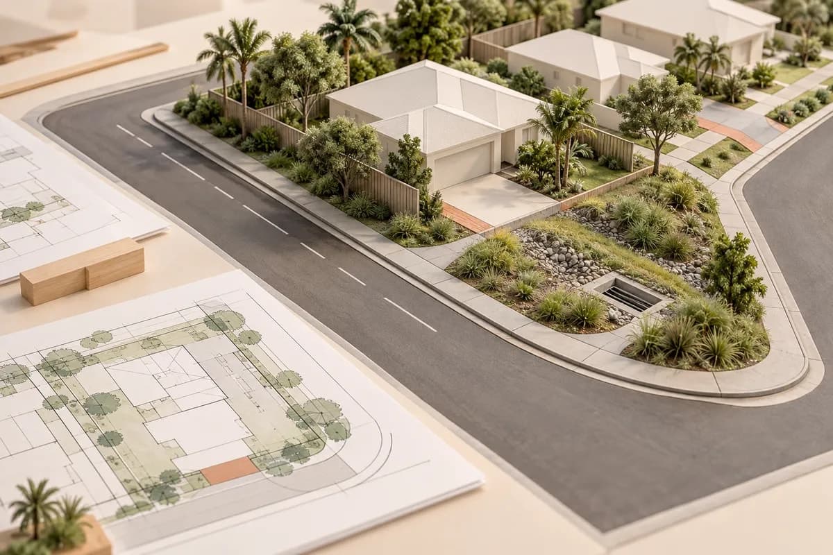
Subdivision · Sunshine Coast
Palmwoods subdivision: character, drainage and environmental constraints before design
A practical Palmwoods subdivision review covering established streets, slope, drainage, vegetation, access and the evidence to gather before committing to a lot layout.
Project question?
Check the civil constraints before committing to your next step.
Send CivilCity the address, current plans, approval stage and the issue you are trying to resolve. We will help scope the right civil engineering input for the project.
Quick answer
Palmwoods subdivision feasibility is rarely decided by lot area alone. Before paying for a detailed layout, test whether the proposed lots can share a workable relationship between the existing street pattern, access, finished levels, stormwater discharge, water and sewer services, earthworks and the site’s vegetation or drainage features.
The practical decision is not simply “can this block be split?” It is whether the intended yield can be achieved without a late redesign, disproportionate frontage or retaining works, an unresolved discharge path, or a project programme that depends on unconfirmed authority or environmental outcomes. Start with a dated concept and an evidence register, then investigate the constraints most likely to change the decision.
Why Palmwoods needs a site-specific feasibility review
Palmwoods sits within the Sunshine Coast hinterland where established streets, older houses, irregular boundaries, local drainage paths and changing ground levels can combine on a single infill site. A concept that looks straightforward in aerial imagery may need to negotiate a narrow frontage, a sloping rear yard, an existing driveway, a mature tree area or a low point that controls the only practical drainage route.
The Sunshine Coast Planning Scheme and Council’s Development.i information help identify planning context and available application history. Use them as starting evidence, not as a substitute for survey and proposal-specific civil review. Planning character, drainage and construction constraints need to be read together because moving one element can affect all the others.
Palmwoods subdivision feasibility decision table
Use this first-pass table to decide what needs evidence before the layout is refined.
| Constraint | Evidence to seek | How it can change the project |
|---|---|---|
| Street and access | Road frontage, existing crossover, grades, visibility and vehicle movements | A rear-lot handle or frontage design may consume usable area or alter the yield. |
| Levels and slope | Feature survey, driveway levels, building pads and retaining assumptions | The concept may need fewer lots, different boundaries or a different earthworks strategy. |
| Stormwater | Low points, upstream catchment, outlet level, ownership and discharge pathway | Building pads, access and lawful discharge may need to move together. |
| Vegetation and site features | Mapped constraints, site observations and proposed clearing or earthworks | The building envelope or construction method may need to avoid or respond to the feature. |
| Water and sewer | Authority records, connection points, levels, capacity and protection requirements | Shared corridors, easements or additional servicing works may affect feasibility. |
| Planning history | Development.i records, decision notices, plans and conditions | An old approval may not support the current layout or assumptions. |
Read access, drainage and levels as one system
On a sloping Palmwoods site, a driveway is also a level corridor, a drainage edge and often the route for services. Test the road tie-in, the retained dwelling, the proposed lot entrance, vehicle movement and the lowest practical pipe route together. A layout that fits in plan may fail once the driveway gradient, retaining footprint and drainage cover are considered.
Start at the likely discharge point and work back through the site. Confirm whether the receiving system is physically reachable, whether the outlet is permitted and whether the proposed earthworks preserve safe overland flow. Do not label a nearby creek, open drain or Council asset as an available point of discharge without proposal-specific investigation and the relevant authority or legal advice.
Treat vegetation and environmental constraints as design inputs
A mature tree, drainage line or vegetated edge can affect more than the clearing footprint. It may influence where earthworks can occur, how construction access is provided, whether retaining is practical and where stormwater can be conveyed without erosion or nuisance flow. Confirm the applicable mapping and approval pathway with the planning and environmental consultants; the civil concept should use the same constraint plan.
Avoid putting the preferred building pads on a plan first and asking the environmental question later. If a feature is controlling, create options around it early: retain and protect it, shift the access or building area, reduce the yield, or investigate the required approval and construction controls before deciding whether the commercial model still works.
Example: a three-lot concept with one usable drainage corridor
Consider an illustrative Palmwoods property with an existing house near the street and a proposed three-lot layout behind it. The initial sketch shows a shared access strip along one boundary and assumes runoff can leave through the rear corner. A preliminary level review identifies that the rear corner is higher than the natural low point beside the retained house, while a vegetated drainage feature limits where fill and retaining can be placed.
The team compares two alternatives. The first keeps three lots but requires a different access alignment, a verified discharge route and careful earthworks staging. The second creates fewer lots with a wider corridor and simpler level relationships. The decision is made only after survey, planning, drainage and environmental questions are identified with their consequences. This example is illustrative; it does not represent a client project, approval or cost outcome.
Checklist for your project brief
Send a coordinated Palmwoods package so the review tests the development outcome that matters.
- Address, lot and plan, intended yield, existing buildings and the minimum acceptable outcome.
- Current survey or available levels, frontage photographs, driveway, pits, drains, low points and visible vegetation.
- Council mapping, Development.i records, title, easements, previous approvals and any environmental information already obtained.
- One dated concept showing boundaries, building areas, access, parking, retaining, earthworks and the assumed drainage route.
- Water, sewer, stormwater and other service records, with unknown connection levels or permissions clearly marked.
- Purchase, planning or design deadline, including the decision that the investigation must support.
Common mistakes that create Palmwoods redesign
The most expensive mistake is fixing the lot yield before checking the level strategy. Other common errors include treating a nearby drain as a confirmed outlet, assuming the existing crossover can serve all lots, ignoring the retained house’s service and access requirements, and placing fill or retaining at the site edge before understanding overland flow.
Do not use a broad environmental or flood label as the conclusion. Identify the actual feature, the evidence relied on, the proposed works that may interact with it and the question that must be answered next. Clear limits make a preliminary review useful; false certainty makes it expensive.
When to involve CivilCity
Involve CivilCity before the Palmwoods layout is fixed or before an advertised yield enters the feasibility model. CivilCity can review the concept against access, levels, drainage, earthworks, services, easements and likely operational-work obligations, then identify where survey, planning, geotechnical, environmental, utility or legal input is needed.
Send the address, dated concept, survey, title information, mapping and decision deadline. CivilCity can scope a proportionate due diligence review and help your planner, surveyor, architect and other consultants work from the same civil assumptions.
Common questions
Does a Palmwoods property with subdivision potential automatically support the advertised yield?
No. The yield still needs to work with the applicable planning controls, street character, access, levels, drainage, services, vegetation and any site-specific constraints. A listing description is not engineering evidence.
Is a creek or drainage feature on or near the site an automatic reason to stop?
Not automatically, but it changes the investigation priority. Confirm how water moves, where discharge could occur, what earthworks are practical and whether planning, environmental or legal constraints affect the concept.
When should a surveyor and civil engineer be involved?
Before the lot yield and building areas are fixed, especially where the site slopes, contains an existing dwelling, relies on a rear access handle or has a low point, drainage feature or mature vegetation near the proposed works.
Can Council mapping confirm that a Palmwoods subdivision will be approved?
No. Mapping and Development.i are useful screening evidence. They do not replace a proposal-specific planning assessment, survey, engineering design, utility advice or any required environmental and geotechnical investigations.
Official sources and further guidance
- Sunshine Coast Planning Scheme 2014
- Sunshine Coast Council: Development.i site report
- Sunshine Coast Council: operational work
- Queensland Government: vegetation management mapping
Use the current requirements for your property and proposal. Illustrative scenarios describe possible design issues; they are not reported client projects.
Discuss your project
Test your Palmwoods subdivision concept
Send CivilCity the address, survey, title information and dated concept so access, drainage, levels and environmental interfaces are tested before design costs compound.