
Local development guides · Sunshine Coast
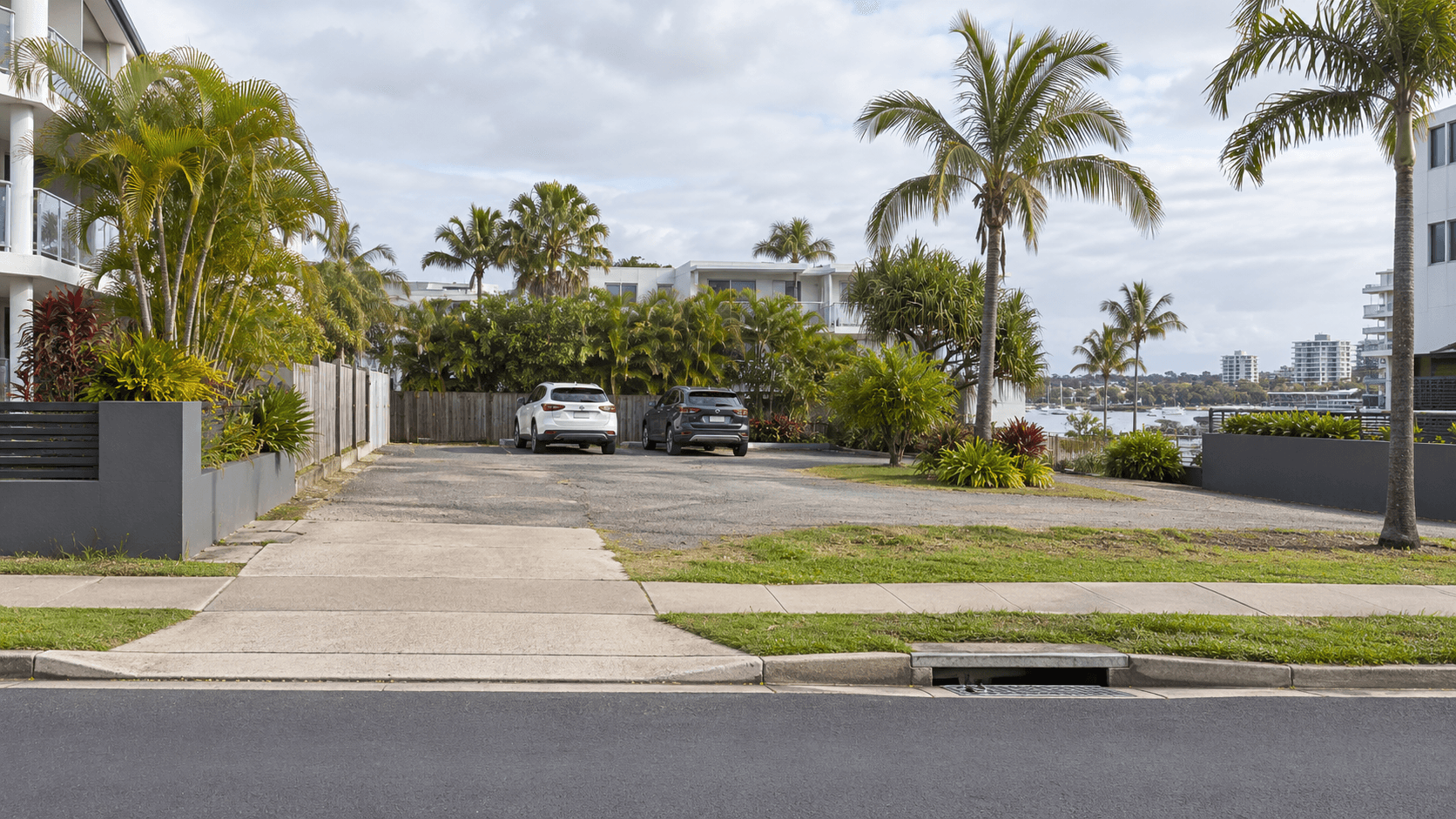
Mooloolaba development sites: parking, access and coastal constraints before design
A practical civil engineering review for Mooloolaba development sites, covering parking, driveway access, stormwater, coastal exposure, services and the evidence to gather before design is fixed.
Project question?
Check the civil constraints before committing to your next step.
Send CivilCity the address, current plans, approval stage and the issue you are trying to resolve. We will help scope the right civil engineering input for the project.
Quick answer
Mooloolaba development feasibility is often decided by the relationship between parking, vehicle access, building levels and stormwater—not by site area alone. A concept can fit the building envelope and still fail when cars need to turn, a driveway crosses a low point, a compliant drainage route consumes the same space, or the frontage cannot safely accommodate the proposed access.
Before committing to a layout, test four things together: how vehicles enter and leave, where every required parking space sits, how runoff reaches an acceptable outlet, and whether the finished levels work with the street and adjoining properties. Then screen the coastal and planning constraints that may change the design response. The result should be a decision about the next investigation or concept revision, not a promise of approval.
Why Mooloolaba sites need an early civil review
Mooloolaba combines established urban streets, compact lots, tourist and residential activity, low-lying coastal areas and intense competition for frontage and usable ground-floor space. A development concept may need to accommodate parking, waste and service access, pedestrian movement, landscaping, flood or overland-flow considerations and a practical stormwater connection within a tight footprint.
That makes civil coordination an early design task. Moving the driveway can change the parking aisle; raising the building pad can affect access and drainage; adding a retaining edge can remove turning space; and locating tanks or pits late can conflict with services or deep planting. Check the current Sunshine Coast Planning Scheme, mapping and application records for the actual site rather than relying on a generic coastal assumption.
First-pass decision table
Use this review before spending heavily on detailed architectural design.
| Question | Evidence to seek | Why it matters |
|---|---|---|
| Can vehicles use the frontage safely? | Road geometry, existing crossover, sight lines, levels and site photographs | A narrow or constrained frontage may limit access location or require a different arrangement. |
| Do parking spaces work in three dimensions? | Scaled layout, turning paths, ramp grades, columns, walls and pedestrian route | A nominal space is not useful if drivers cannot enter, turn or exit comfortably. |
| Where does stormwater go? | Low points, upstream flow, outlet levels, authority assets and discharge pathway | A nearby pit or drain is not automatically an available lawful outlet. |
| What does the coastal context change? | Current mapping, planning controls, flood information and site-specific investigations | The design may need different levels, drainage, materials or approvals. |
| Can services share the corridor? | Title, easements, utility records, survey and authority advice | Parking, drainage and service routes often compete for the same narrow space. |
Parking and access are one civil system
Start with the largest vehicle and the actual movement required by the proposal. Test the street entry, ramp or driveway, parking bays, turning area, loading or waste movements and the pedestrian path together. A plan that shows the correct number of bays can still be unworkable if a wall, column, kerb or ramp consumes the swept path.
For a sloping or low-lying site, compare the road tie-in with the parking level and building entry. Do not solve a flood or drainage concern by raising the site without checking the resulting driveway grade, boundary interface and overland-flow path. If the project relies on a shared access, identify who controls it and whether construction vehicles can use it without damaging the permanent works or neighbouring property.
Coastal constraints need evidence, not slogans
‘Coastal’ is not a complete engineering conclusion. Confirm the applicable overlay, flood or hazard information and the proposed development’s interaction with the site. Separate planning controls from physical design questions: one may identify an assessment pathway while the other asks whether finished floors, drainage, access and construction can work.
For stormwater, begin at the proposed outlet and work back to the site. Check whether gravity drainage is achievable, whether the receiving asset is available for the proposal and whether the arrangement affects neighbouring land or requires a separate agreement. For ground and materials, obtain the relevant geotechnical or structural advice where the site conditions and design warrant it. Civil engineering should make these dependencies visible to the architect, planner, builder and owner.
Example: the extra parking bay that removes the drainage route
Consider an illustrative Mooloolaba infill concept with a compact apartment building, basement entry from the side street and a target parking count that leaves one narrow strip along the rear boundary. The first layout places the extra bay in that strip and sends stormwater toward a nearby kerb inlet.
A coordinated review identifies three unresolved issues: the turning movement crosses the pedestrian route, the ramp changes the low point, and the proposed pipe alignment conflicts with an existing service corridor. The team compares three options: remove the extra bay and retain a simpler drainage route, revise the building and ramp levels, or investigate a different outlet and service arrangement. The preferred option depends on survey, service evidence, planning requirements and proposal-specific drainage design.
The lesson is not that one option will always be accepted. It is that parking yield should not be treated as final until access, levels, drainage and services have been tested together. This is an illustrative scenario, not a client project or approval prediction.
Common mistakes that cost money
The most common mistake is fixing the floor plan before checking the civil corridors. Other costly assumptions include counting bays without testing turning, placing the driveway at the easiest architectural location, treating a kerb inlet as a guaranteed discharge point, ignoring construction access, and leaving service locations to be resolved after the parking layout is complete.
Avoid copying a solution from a nearby project. Different levels, title instruments, road geometry, approval conditions and authority assets can change the answer. Record what is measured, what is mapped, what is assumed and what still needs confirmation. That short evidence register is more valuable than a confident coloured concept.
Checklist for your project brief
Send a coordinated package so the first civil review tests the decision that matters.
- Site address, lot and plan, intended use, yield, parking target and decision deadline.
- Current survey or available levels, frontage photographs, existing crossover, kerb, pits, drainage features and visible services.
- Dated architectural concept showing building footprint, parking, ramp or driveway, loading or waste movements, pedestrian access and proposed finished levels.
- Title, easements, previous approvals, Council mapping and any flood, coastal, geotechnical or utility information already obtained.
- The largest vehicle, access assumptions, construction staging and whether the immediate decision is purchase, feasibility, pre-lodgement, lodgement or detailed design.
- The minimum acceptable outcome and the constraints you are willing to trade: parking count, building area, access location, basement or civil scope.
When CivilCity should be involved
Involve CivilCity before the parking count, driveway position and building levels are frozen. CivilCity can test access, parking geometry, levels, stormwater, services, frontage constraints and likely operational-work interfaces, then identify which questions need a surveyor, planner, geotechnical engineer, utility authority or other specialist.
Send the address, dated concept, survey, title information, mapping and the decision deadline. CivilCity can turn the initial uncertainty into a proportionate review: what can be checked now, what must be investigated next and which concept changes would protect the project from late redesign.
Official resources and limits
Use the current approval documents and official guidance for the site-specific answer. The Sunshine Coast Planning Scheme provides the planning framework; Development.i helps research applications and site information; Council’s mapping and operational-work guidance provide further process context. Flood, coastal, transport, utility, geotechnical and building matters may involve separate authorities and qualified advisers. This article is a decision guide, not approval, legal, flood or construction-safety advice.
Common questions
Does a Mooloolaba site with enough area automatically have enough room for parking?
No. Parking must work with the building footprint, driveway grades, turning movements, pedestrian access, stormwater infrastructure, services and any relevant planning controls. Area on a title is not the same as a workable layout.
Are coastal conditions an automatic reason not to develop?
No. They are a reason to investigate the site-specific planning, flooding, drainage, ground, corrosion, access and construction requirements early. A map label alone does not establish the design response or outcome.
When should a civil engineer review a Mooloolaba concept?
Before parking, access and building levels are fixed, especially where the site is narrow, near a drainage path, reliant on a shared driveway or intended for apartments, townhouses or commercial use.
Can a civil engineer confirm that Council will approve the proposal?
No. Civil advice can test physical constraints, identify evidence and coordinate a proposal, but planning assessment and the approval authority decide the application. The applicable approval documents and current Council guidance control the project-specific pathway.
Official sources and further guidance
- Sunshine Coast Planning Scheme 2014
- Sunshine Coast Development.i
- Sunshine Coast Council mapping
- Sunshine Coast Council: operational work
Use the current requirements for your property and proposal. Illustrative scenarios describe possible design issues; they are not reported client projects.
Discuss your project
Test your Mooloolaba development concept
Send CivilCity the address, dated concept, survey, title information and parking or access assumptions so the civil constraints are tested before design is fixed.